Description
GIS, Mapping & Spatial Analysis Specialization — Beginner-Friendly Training
Course Description
The GIS, Mapping, and Spatial Analysis Specialization is designed for beginners and professionals who want to understand how Geographic Information Systems work and how to apply GIS tools in real-world scenarios. This specialization uses industry-leading software by Esri Inc., giving you hands-on experience with powerful mapping and spatial analysis tools used worldwide.
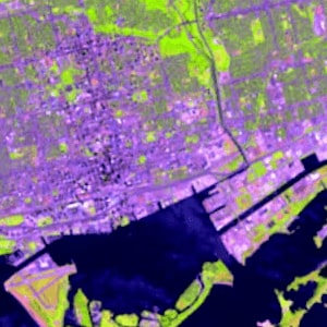
Throughout this program, you will learn how to create GIS datasets, evaluate online spatial data, design high-quality maps, analyze spatial patterns, and work with satellite imagery. The learning experience is practical and customizable—you can tailor assignments to your personal interests or professional field.
In the final capstone project, you will combine all your new skills to develop either a series of mini-projects or one comprehensive GIS project. Your work will be published as a web-based StoryMap, allowing you to showcase your GIS portfolio to employers, colleagues, or clients.
What You Will Learn
-
Geographic Information Systems (GIS) fundamentals
-
Mapping principles and cartographic design
-
Spatial data creation and evaluation
-
Spatial analysis and pattern recognition
-
Working with Esri tools & ArcGIS software
-
Satellite imagery interpretation
-
StoryMap creation and portfolio development
Who This Course Is For
This specialization is ideal for:
-
Beginners with no GIS background
-
Students exploring geospatial technologies
-
Researchers, analysts, and data professionals
-
Environmental, urban planning, and geography enthusiasts
-
Anyone interested in mapping, location intelligence, and spatial data
Course Specifications
-
Platform: Coursera
-
Instructor: Don Boyes
-
Language: English
-
Skill Level: Beginner
-
Number of Courses: 4
-
Estimated Duration: 2 months (10 hours/week)
Specialization Content
The GIS, Mapping & Spatial Analysis Specialization includes:
-
Foundations of GIS and Mapping
-
Creating and Managing Spatial Data
-
Designing Effective Maps and Visualizations
-
Spatial Analysis, Patterns & Satellite Imagery
-
Capstone Project with StoryMap Presentation
Requirements
-
No previous GIS experience required
-
A computer capable of running ArcGIS software
Please Note: Files will be included in this purchase only Full Course Video & Course Resources. You will get cloud storage download link with life time download access.


Reviews
There are no reviews yet.